


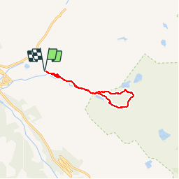


10.3 km | 16.8 km-effort


convivialite, sport et fiesta


FREE GPS app for hiking
 SityTrail
IGN / Geographical institutes
SityTrail World
The world is yours!
Trail Walking of 10.2 km to be discovered at Catalonia, Lleida, Naut Aran. This trail is proposed by Lous Passa camins.
Belle rando au départ du parking de Orri
N42° 42' 23.2"
E000° 574 49.1"
temps de l'hotel 35mn
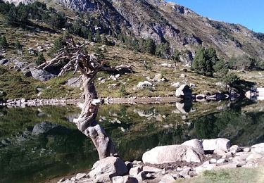
Walking

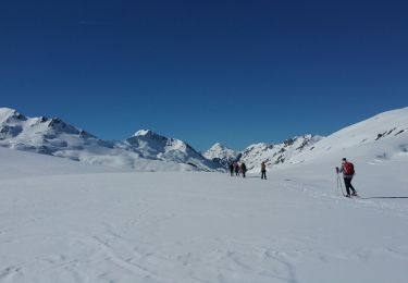
Snowshoes

Walking

Snowshoes
Snowshoes


sport